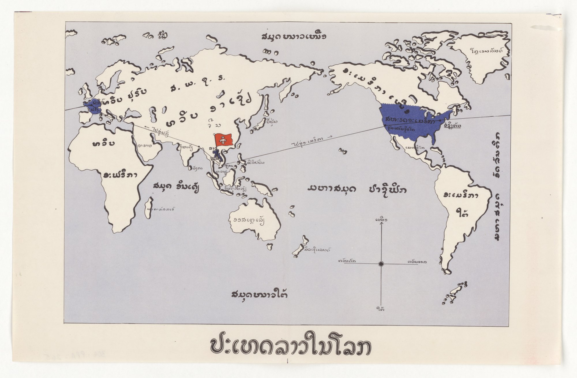
ປະເທດລາວໃນໂລກ (Laos in the World) (Lao poster distributed in Laos)
A Lao-language world map centred on the Pacific. Laos is marked with a red flag; only the United States and France are shaded blue, and two lines run from Laos, one to France and one to the United States. The caption at the foot reads 'Laos in the world'. The tell is card-stacking: of all the countries shown, only two are highlighted and linked to Laos, so the map presents those two ties as the relevant ones without stating a claim.
Propaganda techniques used in this poster
- Date
- May 8, 1953
- Period
- Cold War
- Made by
- U.S. Information Agency (predecessor: State Department International Information and Educational Exchange Program), Propaganda Posters Distributed in Asia series
- Region
- North America
- Country
- United States
- Medium
- Poster
- Issuer type
- State
- Regime
- Eisenhower Administration
- Leader
- Dwight D. Eisenhower
- Audience
- Foreign public
- Purpose
- Persuade or win support
- Theme
- War and the military
- Event
- Cold War
- Source
- Unidentified Source blurred: contractors, cutouts, buried disclosure
- Source
- U.S. National Archives (NARA), Record Group 306, Propaganda Posters Distributed in Asia, retrieved October 3, 2026
- Rights
- Public domain (U.S. government work; NARA RG 306)
U.S. Information Agency / Department of State, May 8, 1953. National Archives, Record Group 306 (NAID 5730166, 306-PPA-265).
Text on the object
ປະເທດລາວໃນໂລກ

[map labels in Lao script, including names of continents, oceans and countries, and the two arrowed route lines; only the large labels are legible]
Laos in the world

[map labels: continents, oceans and countries; individual small labels not rendered]
Small map labels are not transcribed individually.