The Biggest Invasion Fleet the World Has Ever Known
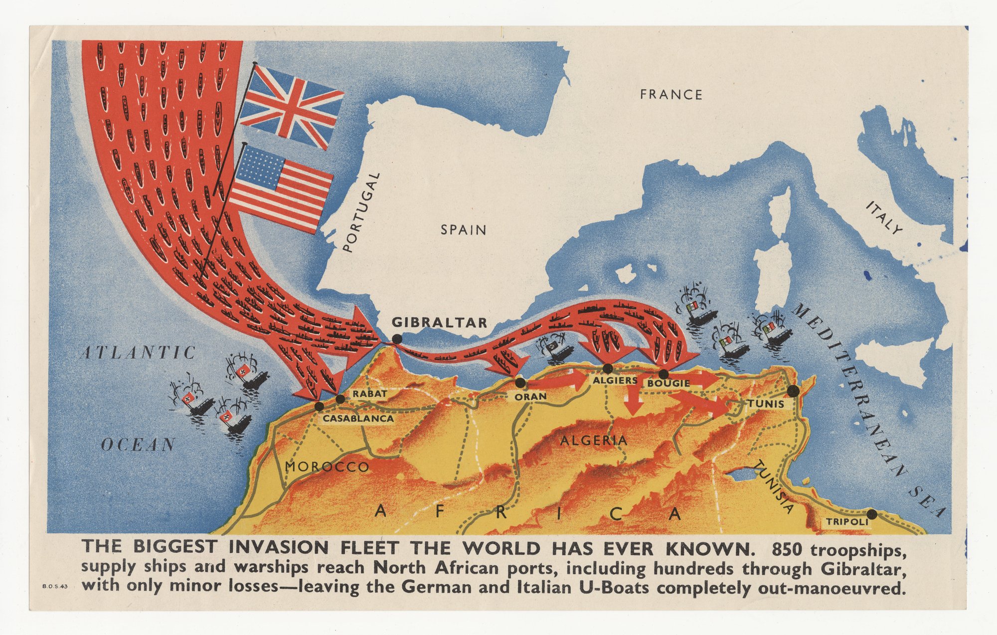
A map shows a red mass of Allied ships under British and US flags streaming through Gibraltar to Moroccan, Algerian and Tunisian ports, while Axis-flagged ships burn at sea. The tell is selection: the claim of 'only minor losses' comes with no figures, and only Axis ships are shown sinking.
Propaganda techniques used in this poster
- Date
- 1939
- Period
- Second World War
- Made by
- Not stated (imprint 'B.O.S. 43' only; British origin inferred from the English text and the Union Flag)
- Region
- Western and Central Europe
- Country
- United Kingdom
- Medium
- Poster
- Issuer type
- State
- Regime
- Churchill Government
- Leader
- Winston Churchill
- Audience
- Foreign public
- Purpose
- Persuade or win support
- Theme
- War and the military
- Event
- World War II
- Leader
- Winston Churchill
- Source
- Unidentified Source blurred: contractors, cutouts, buried disclosure
- Source
- U.S. National Archives and Records Administration, Record Group 44, World War II Foreign Posters, retrieved October 3, 2026
- Rights
- Held by NARA, Unrestricted; hosted by owner decision (publication 1939-1945, UK origin)
Issuer not stated (imprint B.O.S. 43). National Archives and Records Administration, 44-PF-435.
Text on the object
THE BIGGEST INVASION FLEET THE WORLD HAS EVER KNOWN. 850 troopships, supply ships and warships reach North African ports, including hundreds through Gibraltar, with only minor losses—leaving the German and Italian U-Boats completely out-manoeuvred.

Map labels: ATLANTIC OCEAN; PORTUGAL; SPAIN; FRANCE; ITALY; GIBRALTAR; RABAT; CASABLANCA; ORAN; ALGIERS; BOUGIE; TUNIS; TRIPOLI; MOROCCO; ALGERIA; TUNISIA; AFRICA; MEDITERRANEAN SEA

[imprint:] B.O.S. 43