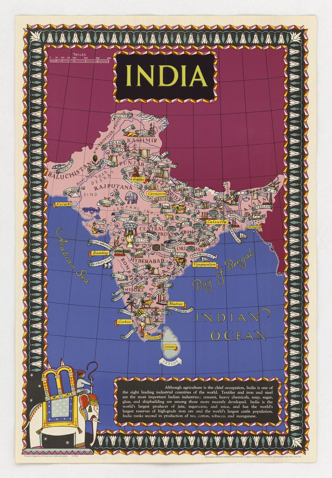
India (pictorial map of products and industries)
A decorated pictorial map of the Indian subcontinent labels crops, minerals and industries by region, with a text panel calling India one of the eight leading industrial countries and the largest producer of jute, sugar-cane and mica. Only output and resources are shown; the map lists no population, wages, famine, trade or political status, so the selection of facts favours the issuer's picture of India under British rule.
Propaganda techniques used in this poster
- Date
- 1939
- Period
- Second World War
- Made by
- British Information Services (an agency of the British Government, New York), printed by Alf Cooke Ltd., Leeds and London
- Region
- Western and Central Europe
- Country
- United Kingdom
- Medium
- Poster
- Issuer type
- State
- Regime
- Churchill Government
- Leader
- Winston Churchill
- Audience
- Foreign public
- Purpose
- Persuade or win support
- Themes
- Empire and colonialism, Economy and finance
- Event
- World War II
- Leader
- Winston Churchill
- Source
- Identified Openly sourced: the speaker is who they say they are
- Source
- U.S. National Archives and Records Administration, Record Group 44, World War II Foreign Posters, retrieved October 3, 2026
- Rights
- Public domain (UK Crown copyright, 50 years from publication, expired before 1996; no URAA restoration)
British Information Services (British Government), c. 1939-1945. U.S. National Archives, RG 44.
Text on the object
INDIA

MILES
0 50 100 150 200 300 400 500

Although agriculture is the chief occupation, India is one of the eight leading industrial countries of the world. Textiles and iron and steel are the most important Indian industries; cement, heavy chemicals, soap, sugar, glass, and shipbuilding are among those more recently developed. India is the world's largest producer of jute, sugar-cane, and mica, and has the world's largest reserves of high-grade iron ore and the world's largest cattle population. India ranks second in production of tea, cotton, tobacco, and manganese.

Printed in England by Alf Cooke Ltd., Leeds and London.  S1-9002.
Distributed by BRITISH INFORMATION SERVICES, an Agency of the British Government, 30 Rockefeller Plaza, New York City.

[map labels omitted: place names, products and industries in banners]