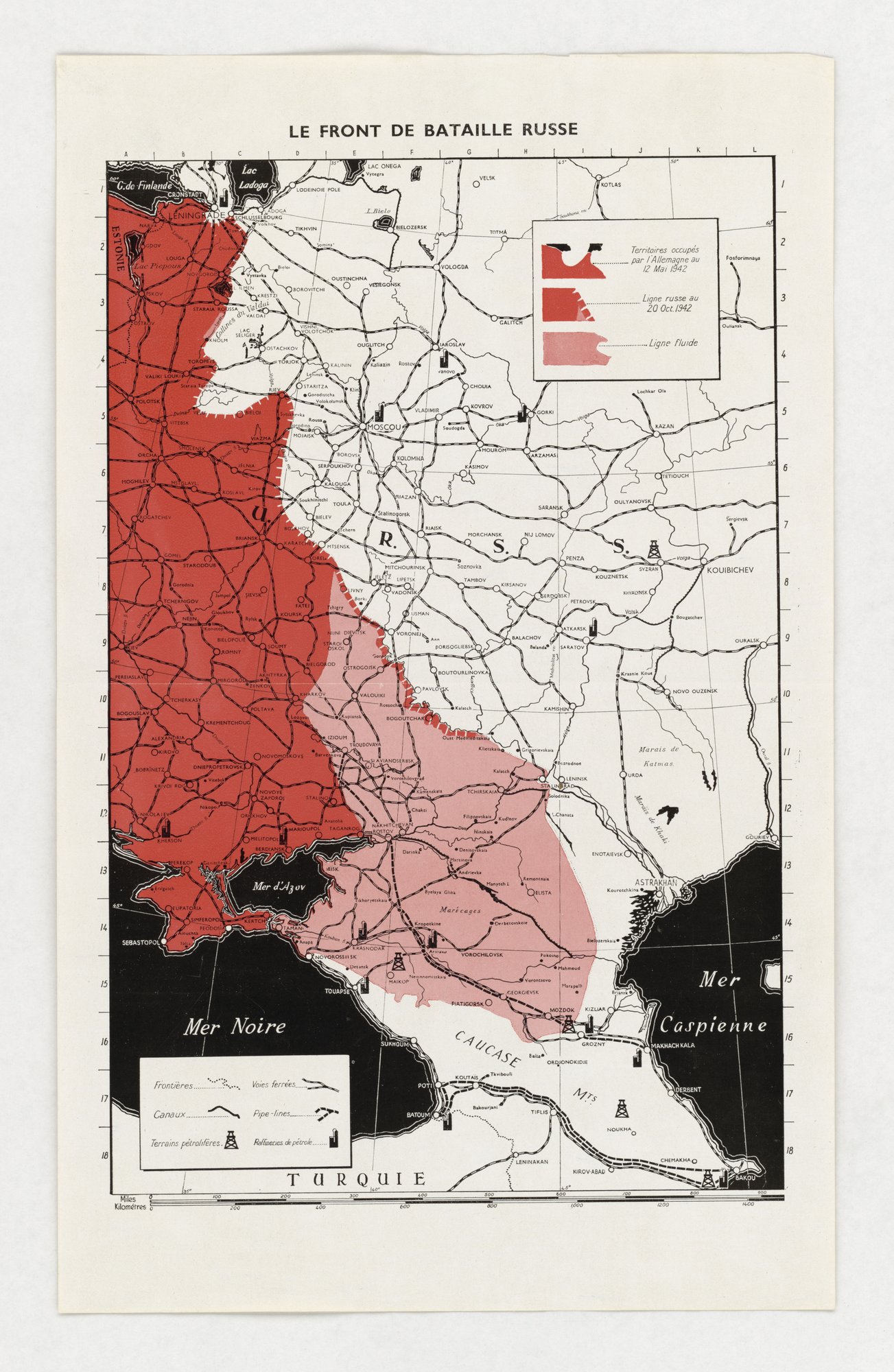
Le Front de Bataille Russe
A map of the Eastern Front from the Baltic to the Caspian shades German-occupied territory (12 May 1942), the Russian line (20 October 1942) and a fluid zone around the Caucasus, with oil fields and refineries marked. It is chiefly an informational map; the closest fit is card-stacking, as only three dated lines and the oil sites are shown, a selection that frames the front as a contest for the Caucasus.
Propaganda techniques used in this poster
- Date
- 1942
- Period
- Second World War
- Made by
- Issuer not stated on the item (French-language map)
- Region
- Western and Central Europe
- Country
- United Kingdom
- Medium
- Poster
- Issuer type
- State
- Regime
- Churchill Government
- Leader
- Winston Churchill
- Audience
- Foreign public
- Purpose
- Warn or inform
- Theme
- War and the military
- Event
- World War II
- Leader
- Winston Churchill
- Source
- Unidentified Source blurred: contractors, cutouts, buried disclosure
- Source
- U.S. National Archives and Records Administration, Record Group 44, World War II Foreign Posters, retrieved October 3, 2026
- Rights
- Held by NARA, Unrestricted; hosted by owner decision (issuer and publication year not stated on the item)
Issuer not stated (French-language map), National Archives and Records Administration, 44-PF-792.
Text on the object
LE FRONT DE BATAILLE RUSSE
Territoires occupés par l'Allemagne au 12 Mai 1942
Ligne russe au 20 Oct. 1942
Ligne fluide
[Translation: The Russian battle front. Territories occupied by Germany on 12 May 1942. Russian line on 20 Oct. 1942. Fluid line.] (Place names, scale and legend not transcribed in full.)