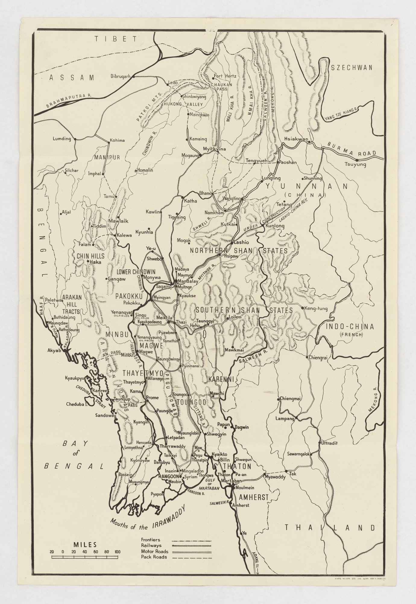
Map of Frontiers, Railways, Motor Roads, and Pack Roads (Burma)
A single-colour map of Burma and neighbouring Assam, Yunnan, Thailand and French Indo-China marks frontiers, railways, motor roads and pack roads, with oil fields and the Burma Road labelled. It is a plain reference map with no slogan or argument; the card-stacking tag is only the closest fit, since the selection of features (communications and oil) reflects its evident military use.
Propaganda techniques used in this print
- Date
- 1943
- Period
- Second World War
- Made by
- Printed by Fosh & Cross Ltd, London (issuing body not printed on the sheet)
- Region
- Western and Central Europe
- Country
- United Kingdom
- Medium
- Issuer type
- State
- Regime
- Churchill Government
- Leader
- Winston Churchill
- Audience
- Own forces
- Purpose
- Warn or inform
- Theme
- War and the military
- Event
- World War II
- Leader
- Winston Churchill
- Source
- Identified Openly sourced: the speaker is who they say they are
- Source
- U.S. National Archives and Records Administration, Record Group 44, World War II Foreign Posters, retrieved October 3, 2026
- Rights
- Held by NARA, Unrestricted; hosted by owner decision (printer Fosh & Cross Ltd, wartime print)
Fosh & Cross Ltd (printer). National Archives and Records Administration, 44-PF-899p.
Text on the object
TIBET
ASSAM
BRAHMAPUTRA R.
SZECHWAN
BURMA ROAD
YUNNAN (CHINA)
MANIPUR
CHIN HILLS
NORTHERN SHAN STATES
SOUTHERN SHAN STATES
INDO-CHINA (FRENCH)
THAILAND
BAY of BENGAL
GULF OF MARTABAN
Mouths of the IRRAWADDY
RANGOON
MANDALAY
MYITKYINA
LASHIO
MILES 20 0 20 40 60 80 100
Frontiers / Railways / Motor Roads / Pack Roads
[place names omitted from this transcription]
[imprint:] FOSH & CROSS LTD.