A Map of the United States of America
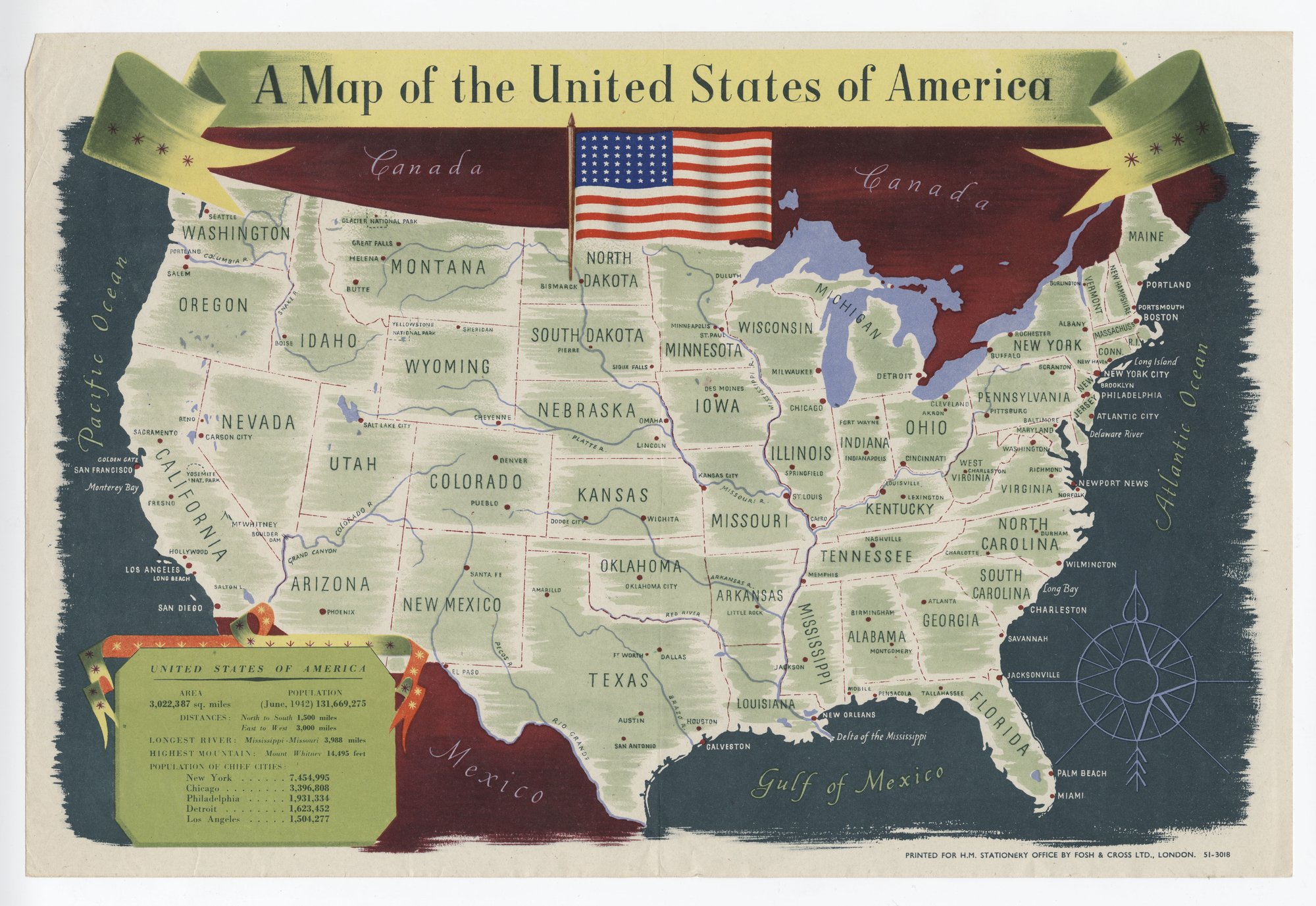
A pictorial map of the United States with state names, cities and rivers carries a flag and a statistics panel (area, population of June 1942, distances, longest river, highest mountain, five largest cities). It is an informational map; the only technique visible is selection, since only favourable size and population figures are listed.
Propaganda techniques used in this poster
- Date
- 1939
- Period
- Second World War
- Made by
- Printed for H.M. Stationery Office by Fosh & Cross Ltd., London
- Region
- Western and Central Europe
- Country
- United Kingdom
- Medium
- Poster
- Issuer type
- State
- Regime
- Churchill Government
- Leader
- Winston Churchill
- Audience
- Domestic public
- Purpose
- Warn or inform
- Themes
- War and the military, Science and technology
- Event
- World War II
- Leader
- Winston Churchill
- Source
- Identified Openly sourced: the speaker is who they say they are
- Source
- U.S. National Archives and Records Administration, Record Group 44, World War II Foreign Posters, retrieved October 3, 2026
- Rights
- Held by NARA, Unrestricted; hosted by owner decision (UK wartime publication)
Printed for H.M. Stationery Office by Fosh & Cross Ltd., London. National Archives and Records Administration, 44-PF-49.
Text on the object
A Map of the United States of America

UNITED STATES OF AMERICA
AREA 3,022,387 sq. miles   POPULATION (June, 1942) 131,669,275
DISTANCES: North to South 1,500 miles; East to West 3,000 miles
LONGEST RIVER: Mississippi-Missouri 3,988 miles
HIGHEST MOUNTAIN: Mount Whitney 14,495 feet
POPULATION OF CHIEF CITIES: New York 7,454,995; Chicago 3,396,808; Philadelphia 1,931,334; Detroit 1,623,452; Los Angeles 1,504,277

[map labels omitted: state, city, river and ocean names]

[imprint:] PRINTED FOR H.M. STATIONERY OFFICE BY FOSH & CROSS LTD., LONDON.  51-3018