Objetivo: Tóquio
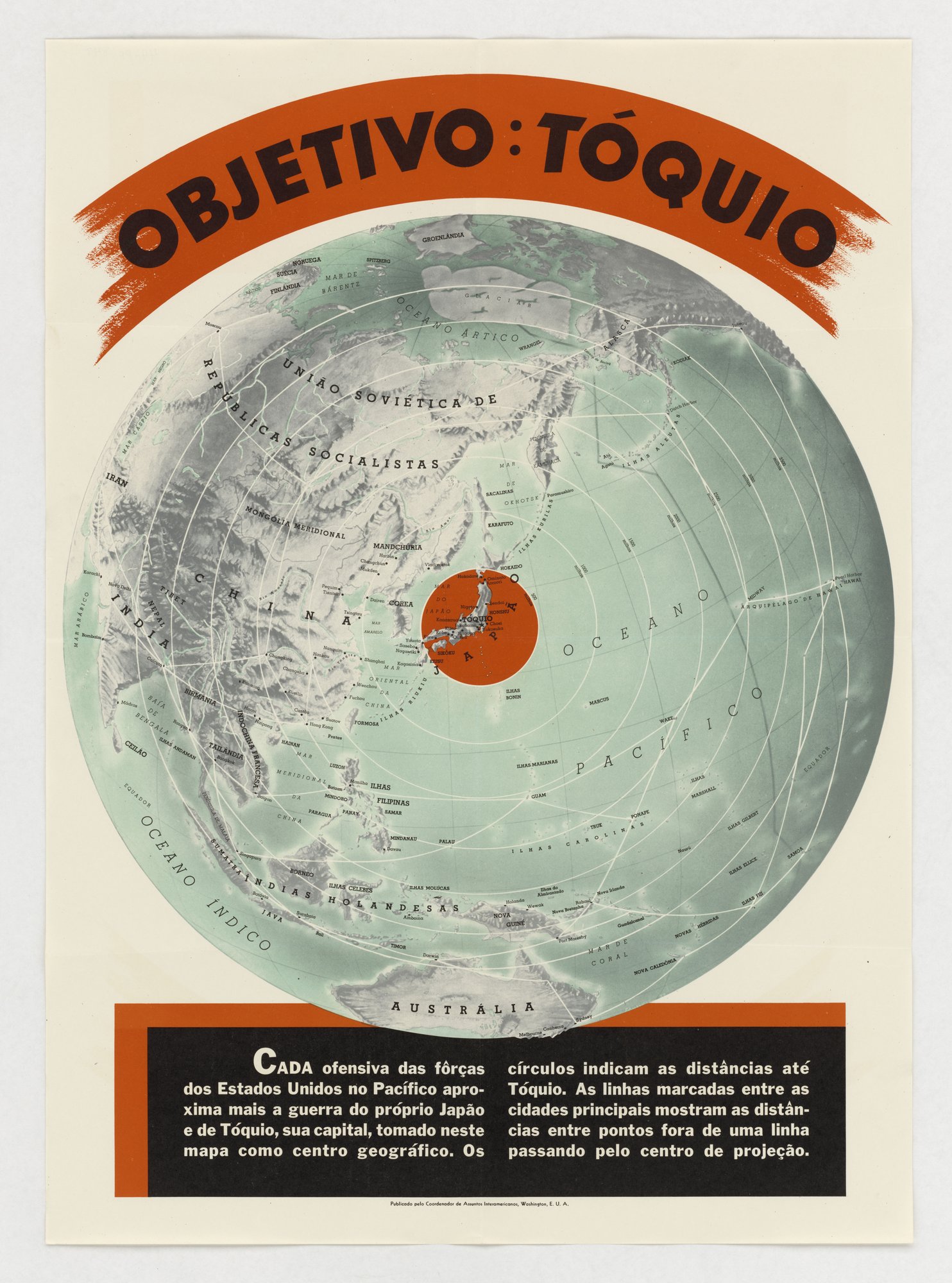
A map of the Pacific and Asia centred on Tokyo, with concentric distance rings and lines between cities, sits under the headline 'Objetivo: Tóquio'. The text says each US offensive in the Pacific brings the war closer to Japan. The tell is the single framing: only distances to Tokyo and US advance routes are shown, with no Allied losses or costs (card-stacking, closest fit for an otherwise informational map).
Propaganda techniques used in this poster
- Date
- 1939
- Period
- Second World War
- Made by
- Office of the Coordinator of Inter-American Affairs (Coordenador de Assuntos Interamericanos), Washington, D.C.
- Region
- North America
- Country
- United States
- Medium
- Poster
- Issuer type
- State
- Regime
- Roosevelt Administration
- Leader
- Franklin D. Roosevelt
- Audience
- Foreign public
- Purpose
- Persuade or win support
- Theme
- War and the military
- Event
- World War II
- Regime
- Roosevelt administration
- Leader
- Franklin D. Roosevelt
- Source
- Identified Openly sourced: the speaker is who they say they are
- Source
- U.S. National Archives and Records Administration, Record Group 44, World War II Foreign Posters, retrieved October 3, 2026
- Rights
- Public domain (U.S. Government work; Coordinator of Inter-American Affairs imprint)
Office of the Coordinator of Inter-American Affairs, Washington, D.C. National Archives and Records Administration, 44-PF-847.
Text on the object
OBJETIVO: TÓQUIO

CADA ofensiva das forças dos Estados Unidos no Pacífico aproxima mais a guerra do próprio Japão e de Tóquio, sua capital, tomado neste mapa como centro geográfico. Os círculos indicam as distâncias até Tóquio. As linhas marcadas entre as cidades principais mostram as distâncias entre pontos fora de uma linha passando pelo centro de projeção.

[imprint:] Publicado pelo Coordenador de Assuntos Interamericanos, Washington, E. U. A.

[Translation: Objective: Tokyo. Every offensive of the United States forces in the Pacific brings the war closer to Japan itself and to Tokyo, its capital, taken on this map as the geographic centre. The circles indicate distances to Tokyo. The lines marked between the main cities show the distances between points off a line passing through the centre of projection.]